Excerpted from "From Cannon to Cave Springs - in Two Different Ways" by Billie Jines
As published by the Cave Springs Scene, 1970
As published by the Cave Springs Scene, 1970
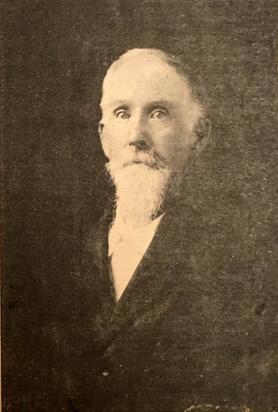
During the Civil War, a young father fighting in the Union Army saw this part of Northwest Arkansas for the first time. Records show that he saw action at the Battle of Prairie Grove. He had been born in Georgia in 1833 and had come to Conway County, Ark., at the age of 19.
When the war was over, E. L. Allen returned to his family in Central Arkansas resolving to re-settle in the the beautiful Ozark mountains he had seen. It took him 15 years, but in 1880 he brought his second wife, (the first had died during the war) and his children to this area. Here he found a cool, sweet spring of water gushing out of a double cave in the side of a mountain some 12 miles from present site of Springdale.
Up to this point the facts have been laid down -- but here the known facts become grown over with legend and hearsay. However, E. L. Allen, has been named by area historians as the first settler in the town now known as Cave Springs. That may or may not be. Apparently, Allen was busy with things other than recording his moves; but he did painstakingly preserve such legal papers as his army discharge, some of the deeds he possessed, etc. These early papers bear out the fact that Allen was then living at what was known as Cannon. The Cannon post office was located in one room of the grist mill until he operated near the spring in what is now known as Cave Springs.
E. L. Allen of Cave Springs
When Goodspeed published the widely - accepted History of Northwest Arkansas in 1899 (about nine years after Allen came to the area), this in part was said of him:
"Elijah L. Allen is one of the successful farmers of Benton County, Ark., and is also engaged in grist milling . . ."
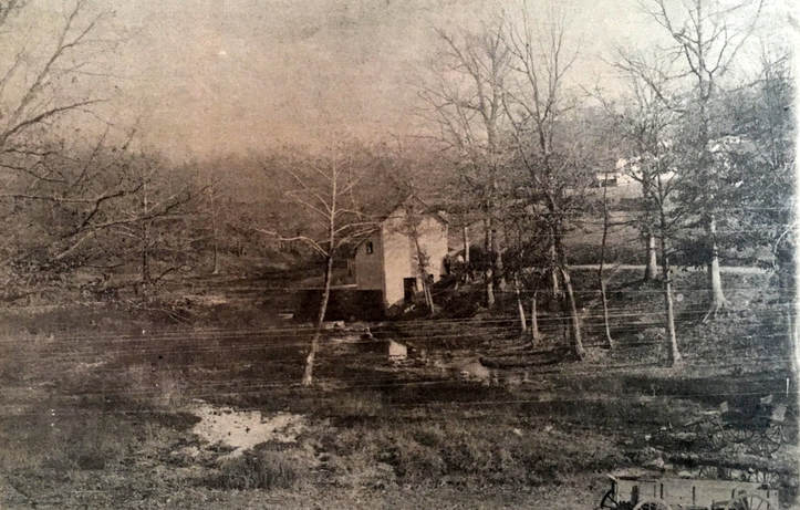
The mill he erected at Cave Springs was said by a Benton County paper at one time to have been "one of the largest mills of that time." It was powered by a large overshot wheel, and it is believed that an earthen dam held back the mill pond that then existed where the great Cave Springs lake now lies. The Allen mill stood on the south shore of the present site of the lake not far downstream from the roaring spring gushing from the hillside. The mill ground flour as well as corn meal.
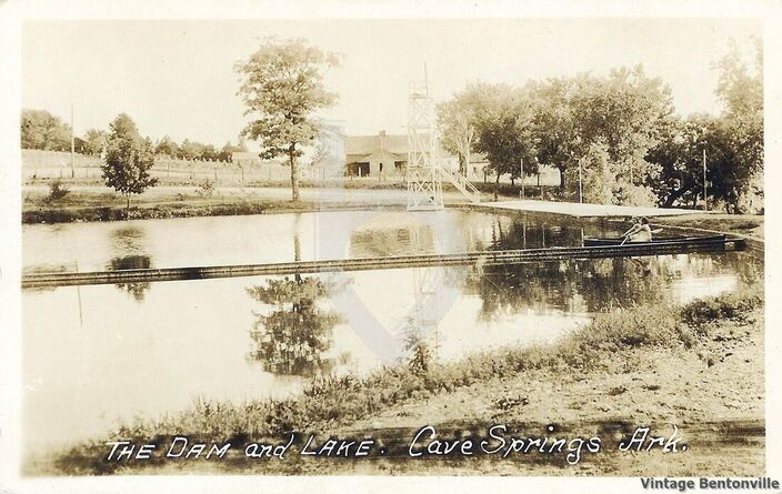
This shows the old mill that stood on the south bank, and toward the left from the mill can be seen the old dam. The remains of this dam, forming steps, is still evident on the south bank near the remains of the 1914 dam. The house seen in the upper right corner is the home of Dr. E. J. Highfill. The dam shown here broke in 1912, and there was no lake until 1914 when W. M. Bartlett bought the springs and built a new dam about midway between the site of the old mill in this picture and the road from which this photo was taken. The present dam forms the roadbed. (Photo from Hazel Shaffer and the Cave Springs Scene 3/11/71)
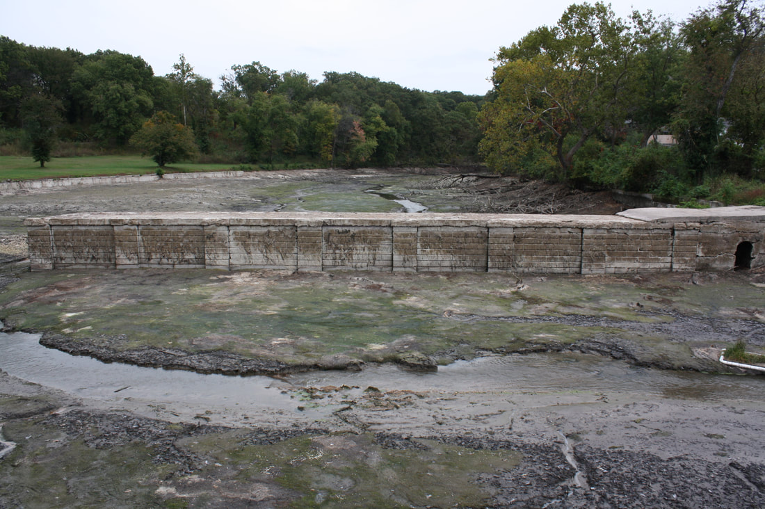
Several years ago the lake at Cave Springs was drained and the old dam from 1914 was exposed.
These images were taken in October, 2013.
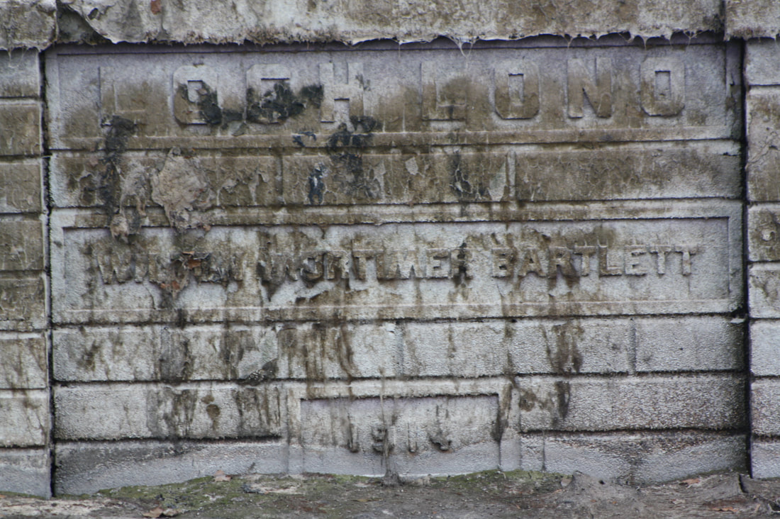
These images were taken in October, 2013.
Old timers at Cave Springs at that time, such as Hobbs Bright, recalled the time (apparently after the dam broke in 1912) when there was no lake there, with the spring water simply running along in a stream. Others point to the old concrete remains of what appear to have been the broken dam a short distance upstream from Dam No. 3. (the one jutting into the lake and still retaining the name "Loch Lono" on its side) and surmise that these old broken remains must have been the one built by the Bartletts after they obtained the area from Allen.
It would thus seem that there have been four known dams to retain the water flowing so abundantly from the cave: (1), The dam built for the Allen Mill, apparently of earth, to form a mill-pond; (2), a concrete dam built by the Bartletts farther downstream sometime about the turn of the century or maybe a few years later later, which apparently was the dam that broke in 1912; (3), the concrete dam erected still further downstream in 1914 by W. M. Bartlett, approximately half of which is still standing today; and (4), the dam erected by E. L. Keith some years ago where State Highway 112 enters the town of Cave Springs from the south.
It would thus seem that there have been four known dams to retain the water flowing so abundantly from the cave: (1), The dam built for the Allen Mill, apparently of earth, to form a mill-pond; (2), a concrete dam built by the Bartletts farther downstream sometime about the turn of the century or maybe a few years later later, which apparently was the dam that broke in 1912; (3), the concrete dam erected still further downstream in 1914 by W. M. Bartlett, approximately half of which is still standing today; and (4), the dam erected by E. L. Keith some years ago where State Highway 112 enters the town of Cave Springs from the south.
View of the 1914 dam built by W. M. Bartlett
When Mr. Keith obtained the spring, lake and adjoining lake area, he entered into an extensive program that included the new dam, (which, incidentally, at first partially failed by letting by letting a great portion fall back into the lake), fish hatchery, and an array of tourist and recreational facilities. The face of the spring -- long a favored spot of natural beauty of area residents -- was altered.
For at least one generation, this meant a revision of the scene of many a Sunday gathering, for the great stone fronts of the spring which had attracted young folks since the day when they had to come by horse and buggy for a picnic beside the gushing cold waters of the spring, were worn slick by the feet of several generations.
The cave from which the water flowed, too, had beckoned the more adventuresome. It had long been known that the south fork of the cave was not a cave of depth. But the north opening, through which the water actually flowed, had been explored by various groups which came out with fascinating tales of a great cavernous room far back in the cave, the sound of waterfalls that couldn't be seen, white fish that were blind, one room inhabited by bats, and low passages where the adventurers had to crawl to pass. Most agreed that even miles of spelunking failed to bring the explorers to the fartherest depth of the cave.
Present day residents of Cave Springs speak vaguely about other owners of lake, such as a Mr. Singletary and a Mr. Young, but no mention is made of many changes in the property from the time the Bartlett dam was erected in 1914 until the lake was renamed Lake Keith several decades later.

